Google Maps is being optimized to serve you better. With a combination of GPS, Google Street Views, Machine learning and Augmented Reality (AR), you can seamlessly find yourself, and your next walking direction.
Prior to now, Google Maps uses lines to indicate your route, and making it somewhat difficult to decipher which is the next direction to start walking since there are no familiar images whatsoever indicated on the map.
Being a common challenge to users, Google started out its journey at the Google I/O 2018 to solve the prevalent situation.
And now, Google is out with the preview version of the optimized Google Map for users to test run and give feedback to Google.
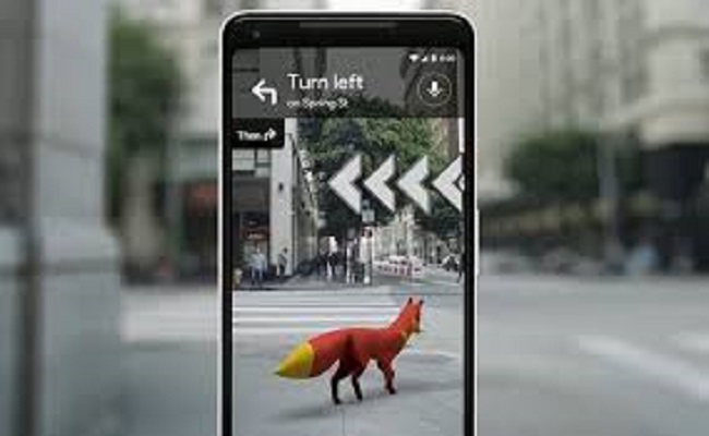
The optimized Google Map is called “global localization”, and it combines visual positioning services with street view and machine learning to accurately display information over the real world.
How it works
—Turn on your GPS.
—Point your phone cameras at your surroundings.
—Machine learning identifies the landmarks based on street view imagery to pinpoint your location.
—It then superimposes it with accurate information such as directions over the real world with an arrow showing you where to navigate.
However, it’s able to perform if there’s a pre-loaded information of your destination.
The preview version of Google’s global localization app is out for test run. Google has not said when the full version will be on the market.

